You won't believe what I found hidden in plain sight...
Revealing Ave Maria's Town Tower
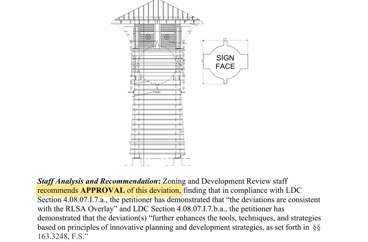
The developer asked the County for a 35-foot tower to welcome you to Ave Maria. Their drawing leaves the sign blank. Look closer.
I am a regular citizen without access to draftsmen and architectural rendering experts. I used the publicly available documents and reference images of Margaritaville properties to generate this image. It is imperfect, as accurate as I was able to make it given the available information.
Ta-da!
This is a rendering of what it seems they're planning.
Located at the intersection of Camp Keais Road and Oil Well Road.
See the evidenceThe town can already have a sign
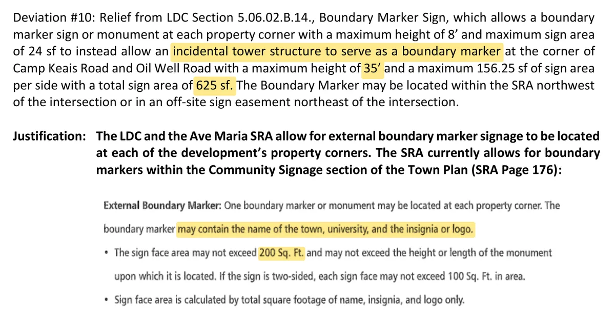
Ave Maria's town plan already allows a boundary marker at each property corner. The rule says what it can show: it “may contain the name of the town, university, and the insignia or logo.”
They asked for one 35-foot tower instead
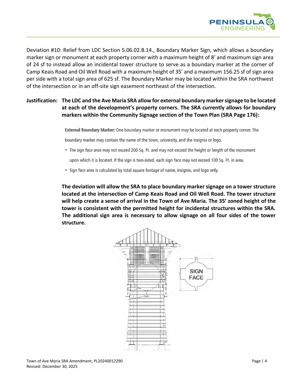
They asked “to instead allow an incidental tower structure to serve as a boundary marker,” with about three times the sign the Town Plan already allowed, on a 35-foot tower. The request leaves out the restriction on what the sign can say. That omission means they're no longer limited to putting only the town or university name or logo on the structure.
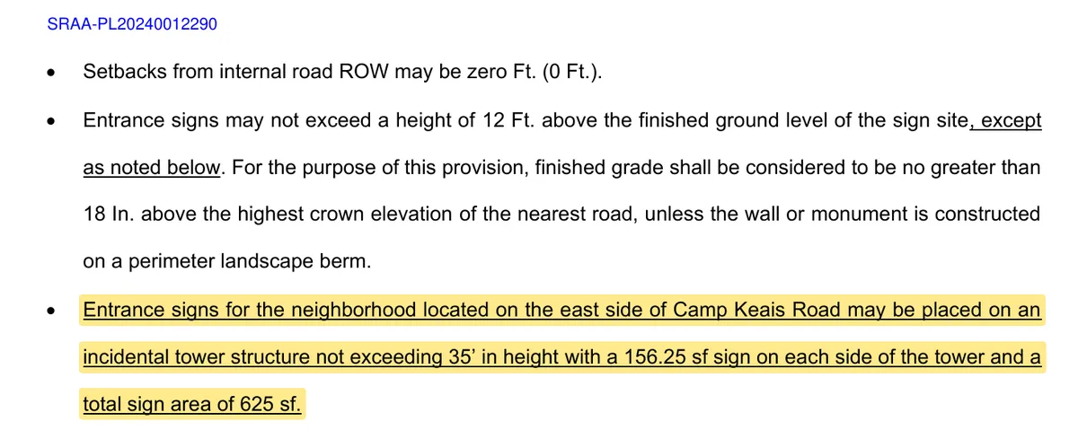
The numbers: the Town Plan allows a boundary marker sign of 200 sq ft. The request asks for 156.25 sq ft on each of the tower's 4 sides, 625 sq ft in all, 3.1 times as much. The County code (LDC 5.06.02.B.14) allows 8 ft and 24 sq ft. Application PL20240012290, PDF page 153.
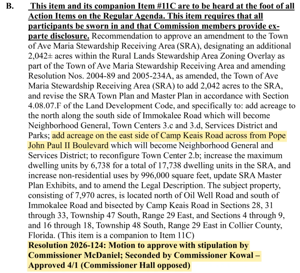
On June 9, 2026, the County Commission approved it, 4–1.
They described it as something for the town:
“The tower structure will help create a sense of arrival in the Town of Ave Maria.”
The application, page 153
Hear them ask for this as if they plan to put ‘Town of Ave Maria’ on it.
The sign is “blank.” Look closer.
This is the drawing their engineers showed the County. The red box is the sign.
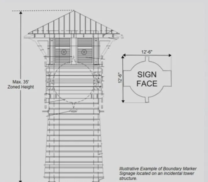
As shown to the County
▼ The red box, enlarged from the filing
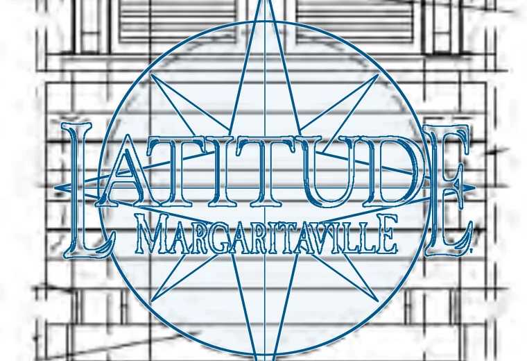
With their logo
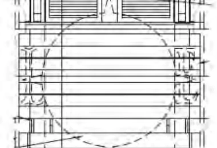
Their drawing
◀ Drag the red handle, or tap the picture. ▶
Left: their drawing. Right: with their logo.
Either side of the “blank” sign are faint outlines of an L and an E. Lay the Latitude Margaritaville logo over the drawing, sized to its circle, and its L and E land right on them. Its circle sits on the sign's circle, and its compass points run through the sign's top and bottom tabs.
Application PL20240012290, Deviation #10, PDF page 153, enlarged. The red box, circles, labels and blue logo outline are added.
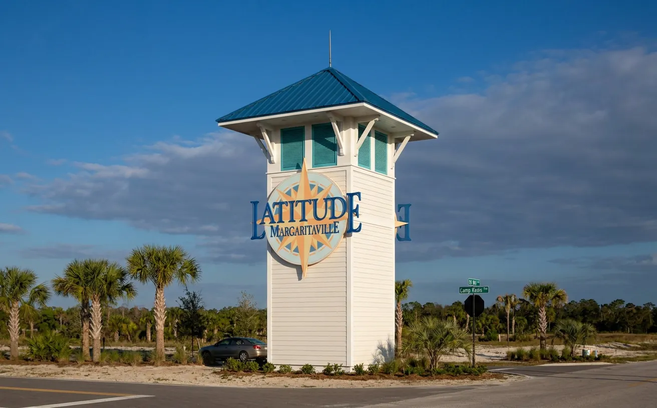
Their buildings, their logo
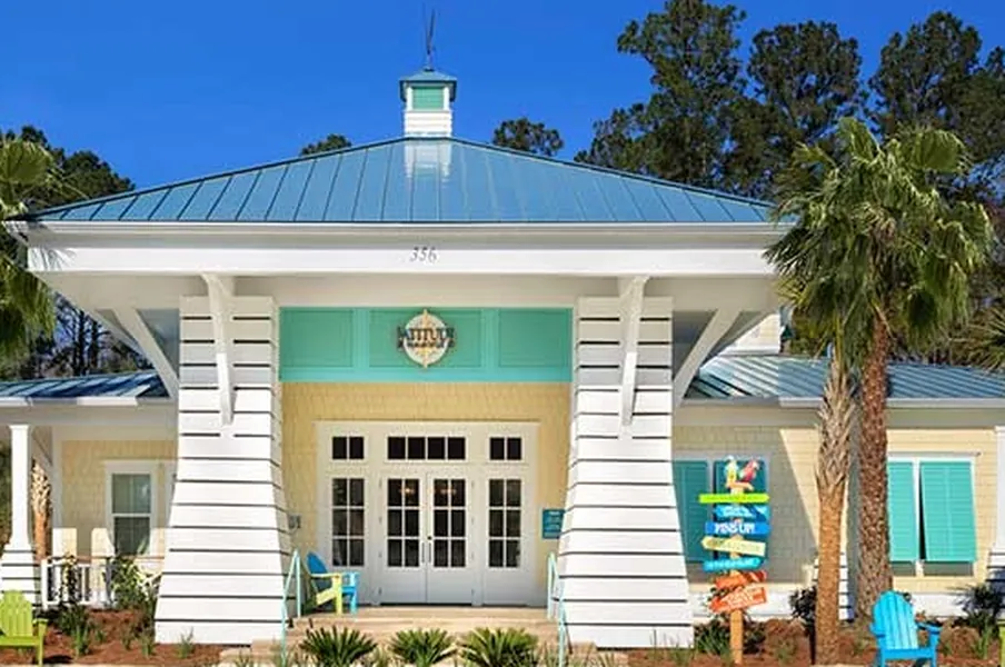
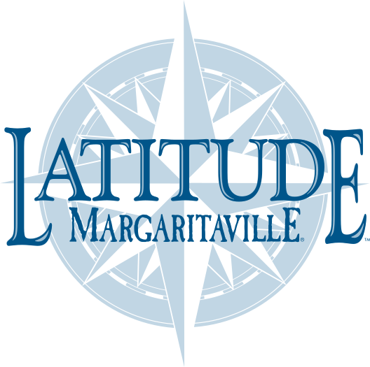
Latitude Margaritaville's own marketing images. Compare the roof, the siding, the shutters and the round sign with the drawing above; the comparison is added.
Whose sign? Not on page 153
The tower is one request on page 153 of a 663-page filing. That page never says “Margaritaville” or names the 55+ community. It speaks only of “a sense of arrival in the Town of Ave Maria.”
The answer is in a separate sentence the developer added to the Town Plan's sign rules:
“Entrance signs for the neighborhood located on the east side of Camp Keais Road may be placed on an incidental tower structure not exceeding 35′ in height with a 156.25 sf sign on each side of the tower and a total sign area of 625 sf.”
Town Plan, Community Signage, page 178: new text in the proposed resolution
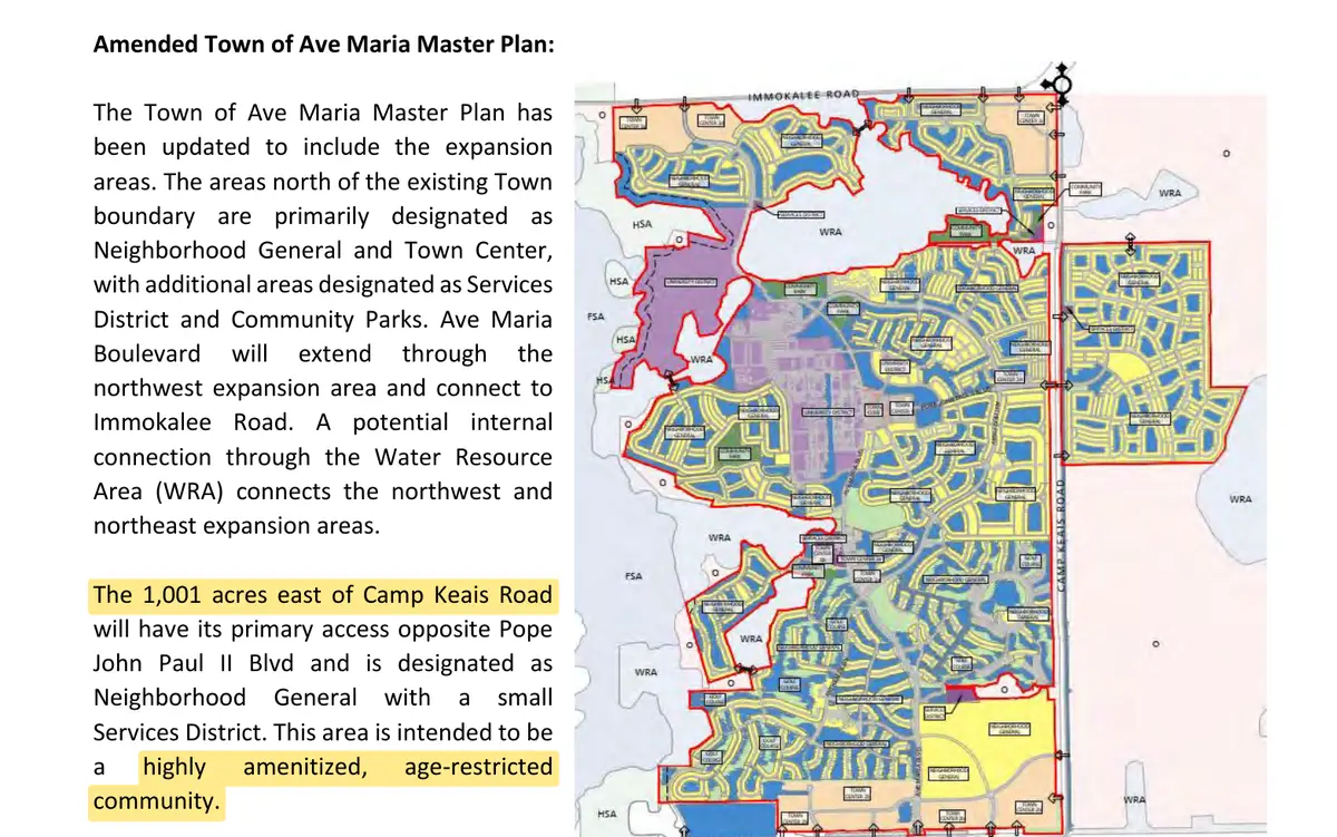
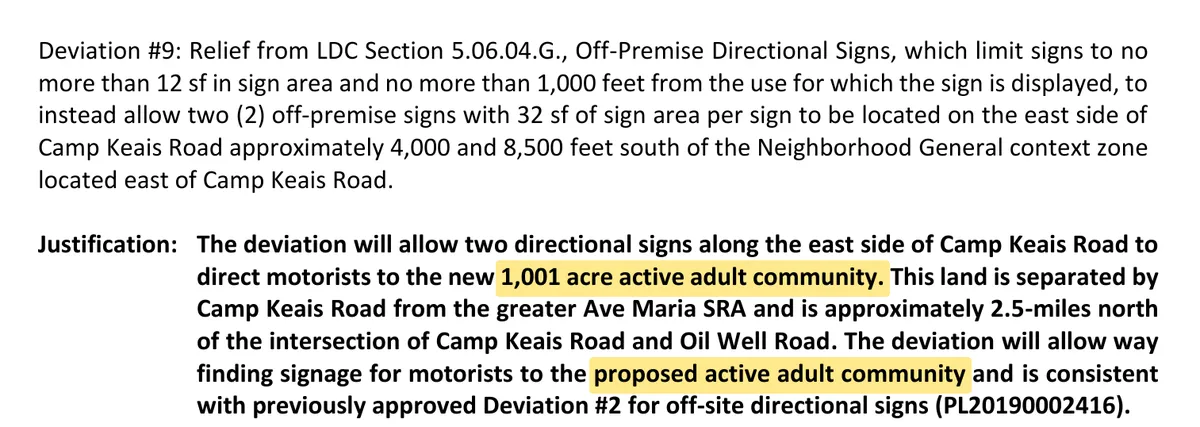
The only neighborhood east of Camp Keais Road is the new 1,001-acre age-restricted community. The filing's traffic study calls it “Latitude.”
See page 153. Application PL20240012290, PDF pages 133, 153 and 257. Proposed resolution, Exhibit C, Town Plan page 178.
How they turned an “Ave Maria” boundary marker into a “Margaritaville Tower”
- Boundary marker to “incidental structure.” The request recast the town's boundary marker as an “incidental tower structure,” 35 feet tall.
- Leave out the limit on what the sign says. The town's rule allows only the town or university name and logo. The request does not carry that limit over.
- Incidental structure to a sign for Margaritaville. A separate sentence in the Town Plan's sign rules puts the “entrance signs for the neighborhood located on the east side of Camp Keais Road” on that tower. That neighborhood is the 55+ community the filing calls “Latitude.”
The County approved a permission for that tower, not a design. I haven't seen another 35-foot tower with over 600 square feet of sign anywhere in Collier County, and I doubt the County would have approved one if it had been asked for plainly.
So they took what was intended as a tasteful boundary marker, limited to the town or university name and logo, and cleverly got to a giant 35-foot directional sign for Margaritaville. All while making it sound like the County was approving something nice for “the town.” Three little tweaks spread across hundreds of pages to make one ugly tower nobody here wants.Greg Colker
Complexity conceals. Clarity reveals.
A favor for the town, a blank sign, page 153 of 663, and the real answer in a different document.
Complexity lets powerful players get away with things we would all oppose if we had the chance. Clarity is the answer: put it in the open, so people can see what is happening and make their voices heard.
Cast your vote to help me fight nonsense like this as your representative on the Ave Maria Stewardship Community District Board of Supervisors.Greg Colker
Election Day is Tuesday, November 3, 2026.
Sources
Check yourself. Let me know what you find.
Show sourcesHide sources
These are the County's own pages, cut down to the passage. The yellow highlights are added; nothing else is changed. Tap a page to see it larger.